
|
There are three main resources that I use for tidal current predictions:
|
|
The Current Atlas is a one time purchase but each year you have to buy tables for use with the Atlas. I recommend using Murrays tables.
Another source for Current Atlas tables can been found at the link below.
Tideview is a computer program that shows tidal predictions in a graphical format. I have found this to be quite accurate for diving. I always reference all of my resources when predicting current but over time I have begun to use Tideview as my favorite resource. Tideview has two views. The first view shows a map of the region in which you can zoom in by clicking and dragging with your mouse. This view also allows you to display the current in an animated movie which shows what the currents are doing frame by frame. You can make the frames go forward manually one at a time by clicking on the "Next!" or "Previous!" buttons or you can click on the "Play!" button and it will advance the frames automatically creating a "movie" of the current. The elapsed time between frames can be set to as low as one minute so you can see what the current it doing on a minute by minute basis. You can enter the second view by double clicking on a point on the map and it will show you the "Tidal Heights" and "Tidal Current" for the point on the map that you double clicked. View One (main window or movie window)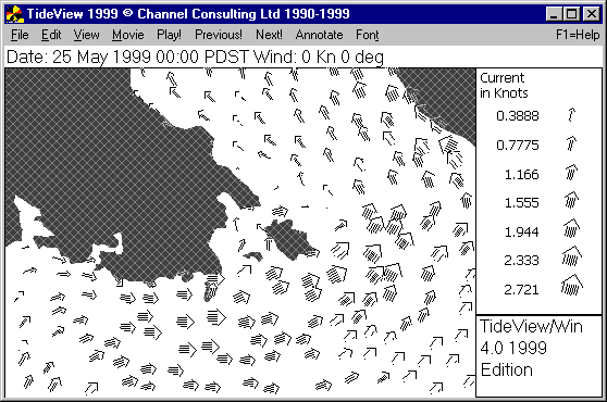 View Two ("Tidal Heights" and "Tidal Current" window)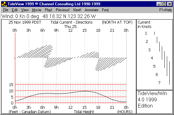
|
 The Canadian Tide & Current Tables and the Current Atlas are both published by the